_edited.jpg)
WATER WELL RECORDS FOR PUBLIC VIEWING
- deannaruthatkinson
- May 12, 2025
- 2 min read
Last month, we explored the Oklahoma Corporation Commission Petroleum Storage Tank
Division’s new interactive viewer, PST Finder. This month, we turn our attention to the
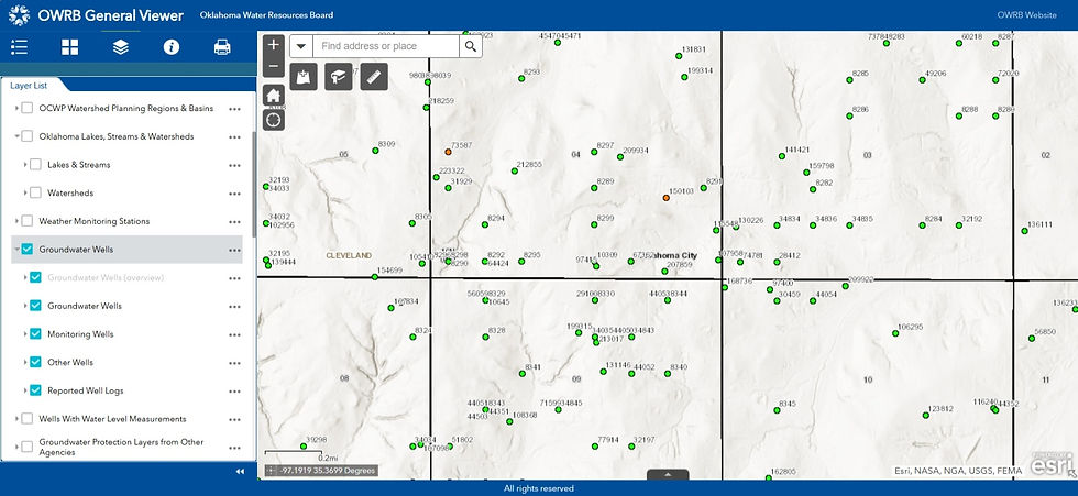
Oklahoma Water Resources Board’s (OWRB) interactive map, the OWRB General Viewer
What’s the connection to petroleum storage tanks? Glad you asked! The OWRB (not to be
confused with the quasi-government energy agency, OERB) manages, protects, and improves Oklahoma’s water resources, including maintaining records of well logs.
Are you curious about whether a prior environmental investigation occurred at a gas station
you’re purchasing? This map is an excellent resource to determine if any soil borings or
monitoring wells were installed in the area.
Planning to install new underground petroleum storage tanks? By querying nearby wells with
water level measurements, you can assess if dewatering the tank pit will be necessary during
installation.
The interactive map also identifies the locations of water wells, which are considered potential receptors if located within 660 feet of a contaminant plume from leaking petroleum storage tanks. While most fueling stations rely on rural or municipal water systems, some—particularly in rural areas—use water wells.
When water is intended for public use, these wells must meet higher construction standards than conventional commercial wells. They are subject to the requirements for minor or small public water supply systems as defined in OAC 252:624-1-2 of the Oklahoma Department of Environmental Quality (ODEQ) regulations.
Non-compliant water wells at convenience store locations have been phased out. If you’re a c-store owner with an unused water well, call me, and let’s get it properly plugged and abandoned. As great as this tool is, it's important to recognize its potential flaws. The data is only as reliable as the information submitted by licensed well drillers.
For example, when I entered my personal address to showcase my three-year-old domestic water well, there was one glaring issue—it wasn’t there! See all the green dots? Mine was missing. This could be due to my driller failing to submit the well log, an incorrect section/township/range listing, or a log processing error.
As a result, my well won’t appear on any maps, and in the event of groundwater contamination, I won’t be notified. I’ll follow up with the driller to ensure my records are submitted, but this highlights the possibility of incomplete data.
Additionally, historical well records can be difficult to locate, as many paper records were
tragically lost in the April 19, 1995, bombing of the Alfred P. Murrah Federal Building.
Despite these challenges, the ability to view statewide water well records remains an incredible resource. It provides valuable insights into how our precious and limited groundwater is being utilized.


Comments